Construction progress monitoring and multispectral terrain mapping work together to maintain safe construction environments and minimize the risk of long-term, potentially expensive structural failure by protecting the value of real estate and infrastructure investments.
For many years, construction progress tracking relied on ground crews walking the site, manual measurements, and visual inspections that depended heavily on an inspector’s judgment. This often led to delayed issue detection and costly rework.
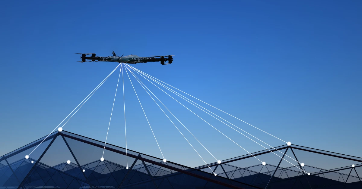
A multispectral inspection using drone technology has changed this model of assessment for construction projects and infrastructure assets by enabling safer access, improving assessment accuracy, and providing quicker results through advanced sensors and AI-enabled analysis.
Traditional site assessments have been limited to ladders, manual walk-throughs, and inspectors relying on their own judgment. The drone multispectral inspection today combines high-resolution imagery, thermal imaging, and intelligent data analysis to reveal problems that would otherwise go unnoticed during traditional inspections.
Issues such as early moisture intrusion, insulation gaps, and structural deterioration are just some examples of site conditions that can be identified more clearly with drone-based assessments, without putting inspectors at risk.
By the end of this guide, you’ll understand how drone multispectral services and construction progress monitoring work together to protect your investments and keep projects on track.
Why Traditional Construction Site Assessments Fall Short
Traditional site inspections can be hazardous for workers and inefficient for project managers.
Safety risks and worker hazards
Inspectors must often navigate steep slopes, uneven terrain, active construction zones, or elevated structures, all of which create serious fall and injury hazards and the potential for liability claims. In addition, they are exposed to extreme heat, cold, and weather conditions.
Many common manual inspection risks are:
- Slipping on unstable or wet ground
- Structural weakness in areas where material has deteriorated
- Extreme temperature exposure when working on large sites.
The more stories and the larger and more complex the structure (i.e., industrial), the greater the danger; thus, safety is the primary concern when considering site monitoring challenges.
Time and cost inefficiencies
Manual site inspections are also highly labor-intensive and slow. It may take hours or days to walk large sites, document findings, and coordinate with multiple teams. This type of inefficiency translates into higher labor costs and lost operating time.
Limited visibility into hidden damage
One significant limitation of traditional inspections is that they cannot detect problems within a structure or at an early stage.
These types of issues may remain hidden behind:
- – Vegetation and ground cover
- – Subsurface soil conditions
- – Early-stage material deterioration
Until they finally become visible on the surface, leading to costly repairs or total failure.
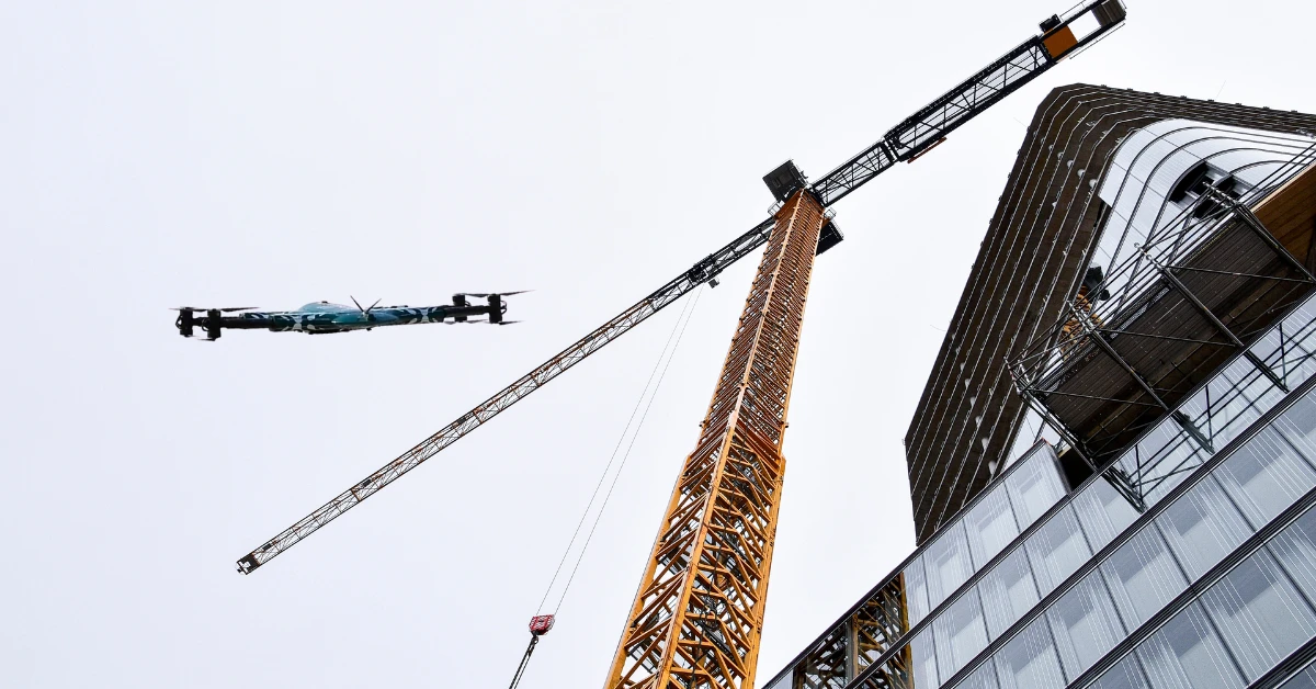
The UAV Advantage for Construction: Precision, Speed, and Safety
The multispectral survey and UAV technology directly address the challenges of manual surveying by delivering a quicker, safer, and more data-rich inspection than ever before.
Fast, minimally disruptive inspections
Drone-based inspections allow an entire construction site to be assessed in minutes rather than hours, making drone services for construction essential for accurate progress tracking and project efficiency.
The time required to assess a site is minimized to disrupt ongoing operations and keep projects moving, especially when conducting residential and commercial multispectral surveys in active building environments.
High-resolution imagery for precise defect detection
UAVs are equipped with high-definition and multispectral cameras that provide high-resolution imagery of site conditions, including drainage patterns, vegetation stress, material deterioration, and structural issues. For more advanced mapping solutions, you can explore drone multispectral services that combine AI and sensor technology for actionable insights.
Safe access to hard-to-reach areas
The use of drones eliminates the need for inspectors to physically access dangerous or difficult-to-reach areas, such as steep slopes, unstable terrain, and active construction zones
For these reasons, drone-based site assessments are now considered one of the best practices for construction and infrastructure projects today.
Choosing the Right UAV for Construction Progress Monitoring & Multispectral Surveys
Not all Unmanned Aerial Vehicles (UAVs) are designed to meet the exact requirements. Choosing the correct platform will ensure the required data is collected safely and accurately.
Tailored solutions by property type
- Residential Properties: Use small, lightweight drones with high-quality video and thermal imaging capabilities.
- Small infrastructure assets: Use multi-sensor drones to comprehensively assess surfaces and temperatures.
- Industrial Facilities: Use high-capacity drones with multispectral or LiDAR sensor payloads to assess the overall condition of larger industrial sites. These drones can collect data on vegetation health, structural integrity, and site topography across large areas.
There is a trade-off for each property type between the time the drone spends flying, the number of sensors it has, and its stability.
Sensor and payload options
Modern drone inspections for construction and infrastructure use a variety of sensor types:
- Visual sensors: Determine whether structures and surfaces show damage and signs of material deterioration.
- Thermal imaging sensors: Locate moisture intrusion and identify gaps in thermal insulation.
- Multispectral sensors: To create detailed maps of material conditions, vegetation health, soil moisture, and site topography across large areas.
- LiDAR (Light Detection and Ranging): Create detailed measurements of the geometry and elevation of structures and terrain.
The combination of these sensors can support a complete UAV multispectral survey process from data collection to reporting.
Beyond Surface Inspection: Subsurface Intelligence
While visual, thermal, and multispectral sensors capture what’s visible on the surface, critical infrastructure decisions often depend on what lies beneath. Concrete slabs, asphalt pavements, and foundation structures may hide rebar, post-tensioned cables, utility lines, or voids that can compromise safety if not identified before drilling or cutting. Drone-mounted Ground Penetrating Radar (GPR) bridges this gap by delivering non-destructive subsurface intelligence. When integrated with construction progress monitoring workflows, GPR data helps project teams verify structural integrity, avoid costly utility strikes, and maintain safety compliance throughout the project lifecycle. For projects requiring precise subsurface assessment, drone GPR concrete scanning provides the visibility needed to drill, cut, and build with confidence.
Why Multispectral Data Matters for Construction
While visual and thermal sensors capture surface conditions, multispectral technology adds a critical layer of intelligence for construction sites. It reveals:
- Soil moisture patterns that affect foundation stability and drainage planning
- Vegetation stress that may indicate buried utilities or environmental compliance issues
- Material composition differences that help classify stockpiles and track resource movement
- Historical site conditions through time-series analysis, enabling predictive maintenance before problems escalate
Multispectral sensors capture data beyond the visible spectrum, allowing analysts to detect subtle surface variations, moisture patterns, and environmental changes that standard imagery may miss. These insights improve decision-making accuracy across construction planning and monitoring workflows.
Flight autonomy and obstacle avoidance
Many advanced UAVs include an autonomous flight plan that can be used with an obstacle-detection system. This has reduced pilot workload, improved consistency, and enhanced safety during autonomous roof inspections.
Step-by-Step Multispectral Survey Workflow for Construction & Infrastructure
Structured workflows ensure that all data collected during a drone-based site assessment is accurate, supports regulatory compliance, and produces actionable results.
1. Pre-Flight Planning & Site Assessment
Before taking off on an aircraft, an operator completes several items before flight, such as:
- Verify the safety of all equipment used during the flight.
- Identify airspace and regulations to operate a UAV in a given area.
- Perform a site layout or risk assessment to identify possible hazards.
Pre-flight planning will ensure compliance and help you achieve your objectives.
2. Data Capture
While operating the UAV, it captures:
- High-resolution images of the site to assess overall conditions, material integrity, and progress status
- Thermal data to detect moisture intrusion, insulation gaps, and subsurface issues
- Data on multi-spectrals to evaluate the condition of construction materials
A proper flight plan is developed to allow the UAV to collect data across the entire site.
3. Optional AI Analysis
Once the raw data is collected, an AI analysis tool will review that raw data to identify:
- Site locations with possible signs of early wear or material stress.
- Potential moisture intrusion zones, drainage issues, and areas of material stress.
- Generate predictive insights to support proactive site management and maintenance decisions.
The use of AI for analyzing raw data transforms it into actionable information, and for construction sites, these insights feed directly into drone multispectral services workflows.
4. Reviewing Data & Creating Reports
Once the data has been analyzed, the results are presented in clear, visual formats that are tailored to the needs of:
- Home owners
- Property managers
- Insurance adjusters
These insights improve decision-making accuracy across multispectral terrain mapping workflows.
AI and Multispectral in Construction & Infrastructure Surveys
Improved Detection Accuracy
Site defects and stress patterns are consistently identified by machine learning algorithms analyzing images, thereby improving the consistency of AI-powered site analysis and reducing human error.
Historical Tracking and Trend Analysis
Drone surveys provide a baseline against which subsequent inspections can be compared, allowing historical tracking of deterioration trends. Historical tracking offers a basis for more innovative budgeting and scheduling of site monitoring activities.
Predictive insights for long-term planning
Early warning signs of potential failures are identified using AI, which provides predictive maintenance insights to prevent costly repairs and extend asset lifespans.
Residential and commercial decision support
Site monitoring analytics support informed, data-driven decision-making for both residential homeowners considering repairs and facility management professionals overseeing multiple properties.
Everyday Use Cases in Construction and Infrastructure
Commercial and residential inspection services are flexible and adaptable to a variety of industries.
Construction projects and apartment complexes
Drone multispectral services provide fast, accurate assessments without disturbing occupants, making them ideal for all types of roof inspections and evaluations following storm damage.
Small infrastructure assets
Regular drone-based commercial roof inspection services will help eliminate downtime and surprise maintenance costs for small retail centers, office buildings, and warehouse owners.
Solar panel assessments
UAVs can inspect both the roof of a property and the solar panels simultaneously, allowing identification of hotspot areas, shading issues, and mounting hardware problems.
Insurance claims documentation
The high-quality images obtained by a UAV will support documentation of an insurance roof survey and provide visual evidence of damage when verifying or resolving insurance claims.
Construction Progress Tracking
For active building projects, regular drone surveys document every phase of construction. Project managers can verify that work matches plans, identify delays early, and maintain accurate records for stakeholders and lenders.
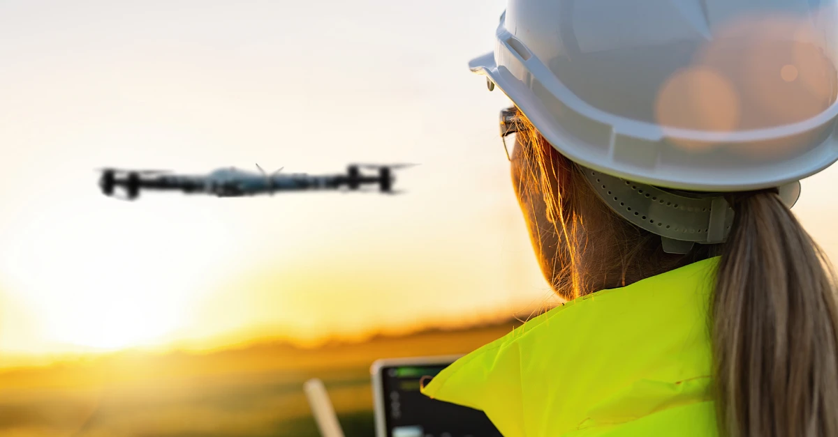
Safety, Compliance, and Best Practices for Construction Drone Operations
Safety in all aspects of UAV operation is a significant concern for a successful UAV Multispectral Inspection.
Certified pilots and regulatory compliance
Professional UAV inspections are performed by FAA-certified pilots who understand local airspace and the UAV’s operational restrictions.
Safe operational standards
The following are some examples of best practice:
- Conducting Pre-Flight Safety Audits
- Using Controlled Launch and Landing Zones
- Monitoring Flights in Real-Time
These operational safety standards are consistent with UAV operational standards and with the regulatory requirements for performing commercial building inspections.
Documentation and reporting
Properly documented flight logs, imagery archives, and inspection reports provide evidence of compliance and help protect against audit failures, insurance claims, and regulatory compliance review issues.
Conclusion: Future-Proof Your Construction & Infrastructure Surveys
In addition to increasing safety, efficiency, and data-driven decision-making through a reduced need for manual reporting of multispectral data quality and visual inspection of roofs from the ground, the use of UAVs in construction and infrastructure assessments has greatly increased the ability to monitor sites quickly and accurately with the aid of multispectral terrain mapping and AI-powered analytics as part of Drone as a Service (DaaS) workflows.
Therefore, due to rising property maintenance costs and heightened safety expectations among owners and managers, adopting drone-based construction monitoring and multispectral site assessments is no longer an option; it is simply a better way to protect your assets while creating maximum long-term value.
Frequently Asked Questions (FAQs)
It uses drones equipped with advanced sensors to capture data beyond visible light, helping detect issues like moisture, stress, and material changes.
It provides faster, more accurate site data, allowing project managers to track progress and identify delays or defects early.
They are time-consuming, risky, and limited in detecting hidden or early-stage structural issues.
Common sensors include visual cameras, thermal imaging, multispectral sensors, and LiDAR for mapping and analysis.
Yes, when combined with technologies like ground penetrating radar, drones can identify subsurface issues such as voids or utilities.
Yes, they reduce the need for workers to access dangerous areas like roofs, slopes, or unstable structures.
AI analyzes collected data to detect patterns, identify defects, and provide predictive insights for maintenance and planning.
Construction, infrastructure, real estate, solar energy, and insurance all benefit from improved inspection accuracy and efficiency.
They can be done regularly—weekly or monthly—to track progress and catch issues early.
They deliver faster, safer, and more detailed insights, helping protect investments and improve decision-making.


